Red River's rising water level poses flooding risk
VGP - As of Tuesday noon, the water level of the Red River reached 9.5 meters, hitting the Alert Level 1 (out of five alert levels).
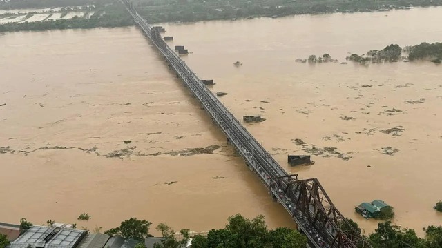
The water level of the Red River reaches 9.5 meters, hitting the Alert Level 1 by Tuesday noon
The Ha Noi City Steering Committee for Disaster Prevention, Search and Rescue has warned the Alert Level 1 on the Red River in the districts of Bac Tu Liem, Tay Ho, Ba Dinh, Hoan Kiem, Hai Ba Trung, Hoang Mai, Long Bien, Thanh Tri, Dong Anh, and Gia Lam.
Torrential rain induced by superstorm Yagi across the northern region and the release of water from hydropower reservoirs further upstream have caused the Red River's water level to rise rapidly, resulting in inundation in low-lying areas along the riverbanks in the capital city.
As of Tuesday morning, the rising water level flooded residential areas in Hoan Kiem District and prompted the evacuation of a few riverside residential areas.
Alert Level 1 indicates the beginning of a flod with water levels remain within river banks, classified as minor flooding.
Alert Level 2 occurs when the river water rises to 10.5 m, triggering flooding that impacts residents, the economy, and society, classified as moderate flooding./.