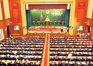
NA passes land use planning by 2020
VGP – With 86.8% of vote in favor, the National Assembly on November 22 adopted the Resolution on Land Use Planning by 2020 and the national-level Land Use Plan for the 2011-2015 period.
 |
|
NA deputies press buttons to pass the Resolution, Hà Nội, November 22, 2011 – Photo : VGP/Nhật Bắc |
Under the Resolution, rice fields would increase to 3.81 million hectares to ensure food security in the long term to respond to growing population pressures, challenges caused by climate change, sea level rise, and land use for other purposes.
By the next ten years, the area for industrial zones will have increased to 200,000 hectares from the current figure of 72,000 hectares.
By 2020, preventive forest coverage will have reached 5.842 million hectares.
Urban area will occupy 179,000 hectares in 2015 and 202,000 hectares in 2020.
Meanwhile, by 2020, land areas used for cultural, education, healthcare, and sport facilities will have been doubled from the current rate to meet people’s demand.
The NA deputies clarified eight tasks and solutions on land use.
Accordingly, localities will have to map out their land use plans on the basis of the national-level plan; clearly define the boundary of rice fields, and preventive forests for preservation; closely supervise development plans of economic zonea, industrial parks, and non-agricultural production sites; protect and develop forest coverage; and contribute to the amendment of the Law on Land.
Areas for different types of land
Unit: 1000 hectares
|
Norms |
Land Use Planning by 2020
|
Land Use Plan for 2011-2015 |
|
- Salt production |
15 |
15 |
|
- Aquaculture |
790 |
750 |
|
- National defense |
388 |
372 |
|
- Security |
82 |
78 |
|
- Infrastructure development |
1.578 |
1.430 |
|
- Remaining |
1.483 |
2.097 |
By Kim Anh

